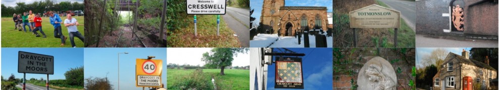
Draycott in the Moors Parish Council covers a semi-rural civil-parish area located on the line of the Roman Road through Staffordshire. It covers an area of 1,587 hectares and includes the semi-rural settlements of Cresswell and Totmonslow, and hamlets of Newton, Draycott Cross and Brookside.
See Draycott Council boundaries
If you live in Draycott-in-the-Moors, Totsmonlow, Draycott Cross, Newton or Cresswell, you will most likely come inside Draycott-in-the-Moors Parish Council’s boundaries.
Draycott in the Moors Parish Council is part of the local government, being the most local of all government authorities. It is funded by a portion of the council tax called the Precept.
Elections to become a Parish Councillor are held every four years. Draycott-in-the-Moors has around 850 registered electors on the electoral roll.
DRAYCOTT itself is a small linear village dominated by the thirteenth century church of St. Margaret’s which stands on a knoll overlooking the A50; (with a fine early English bell tower and a medieval family chapel dedicated to tombs of the Draycott family).
CRESSWELL is a rural settlement which is home to the Catholic church of St. Mary’s in Cresswell Old Lane. Cresswell also has an industrial area adjacent to the Railway line, with many small businesses – Blythe Park Business Park.
TOTMONSLOW was the centre, an ancient ‘Hundred’ in the county of Staffordshire in Anglo-Saxon times.
NEWTON is named in the Domesday Book.

Leave a reply to Elaine Prime Cancel reply